
![]()
 Project title: A Service Platform for Aggregation, Processing and Analysis of Urban and Regional Planning Data (Plan4business)
Co-funded by: 7th Framework Programme of the European Commission
Call and objective: FP7-ICT-2011-SME-DCL, Collaborative project
Grant Agreement No: 296282
Duration: 04/2012 – 03/2014
Total budget: 2.54 million €
Consortium: 6 partners / 5 countries
Website: http://www.plan4business.eu/
The current trend in the EU is to open access to public sector information which is provided either for free or for
marginal cost, and reuse it for various applications. Next to the EU legislation supporting this process, such as the EU directive on the Re-use of Public Sector Information (PSI directive) or the Infrastructure for Spatial Information in the European Community (INSPIRE directive), other initiatives can be recognised. These include open data, linked open data and big data projects.
All the related legislation and initiatives aim to release information in an interoperable way suitable for reuse. As
identified by recent studies, e.g. by Koski (2011) [1], releasing public sector information for reuse has a considerable benefit for economic growth.
An important part of public sector information is spatial data. Spatial or geographic data are defined by the
International Organization for Standardisation (ISO) as “data with implicit or explicit reference to a location relative to the Earth.” [2]
» UWB was responsible for designing methodology for data harmonisation and securing interoperability between different data sets. «
Recent developments in information technologies enable people to access, process and analyse spatial data from
various sources, help to design on-demand maps and provide information for decision makers. However, the provision of data varies across different authorities, and combining heterogeneous data is not an easy task.
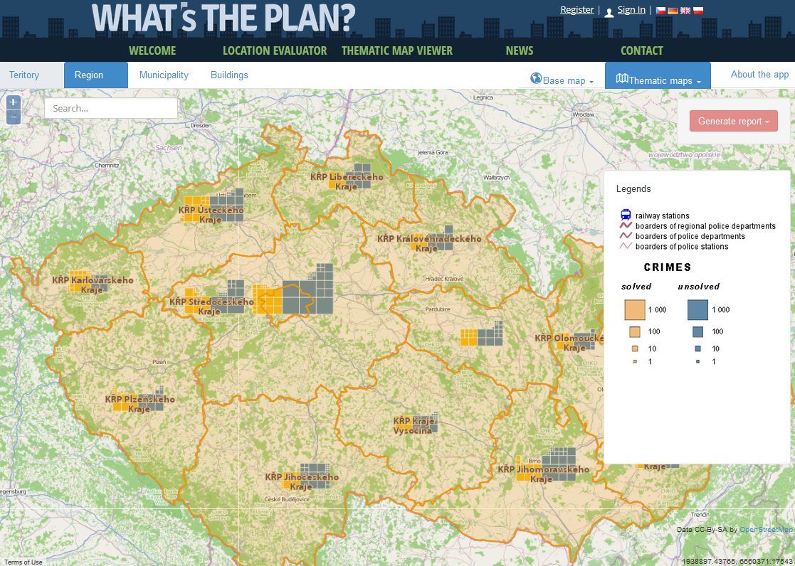
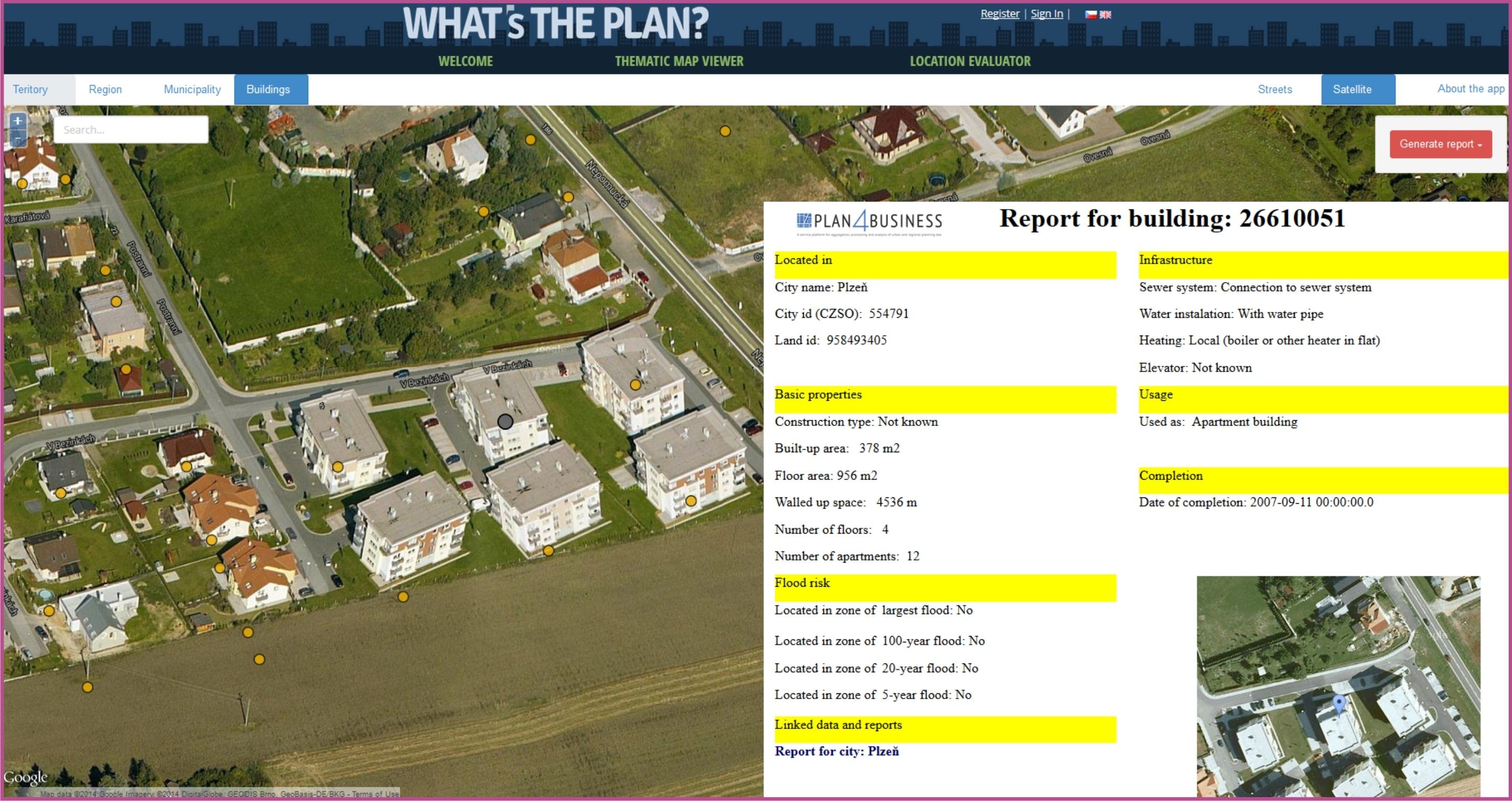
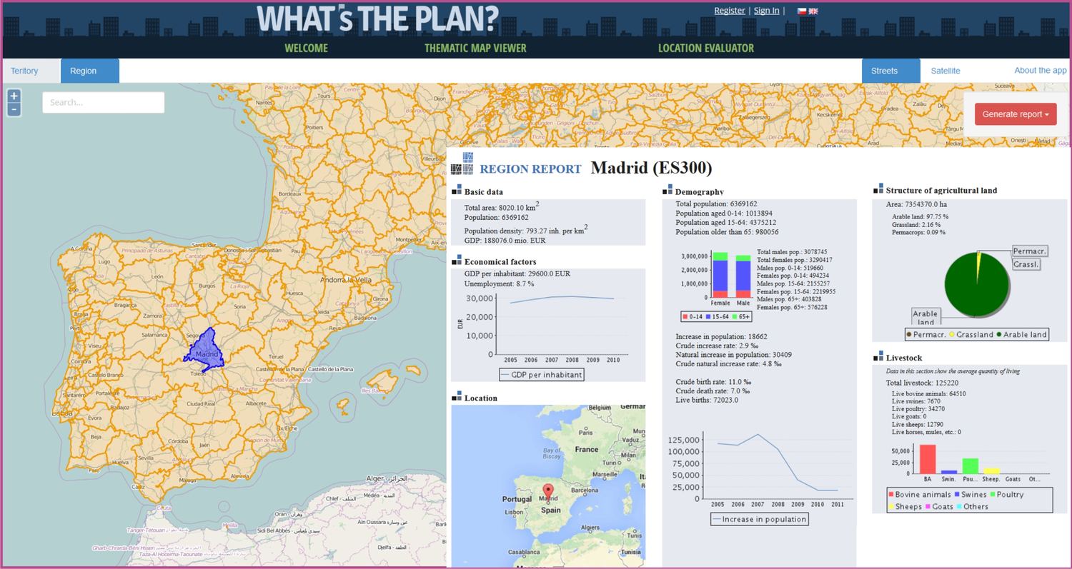
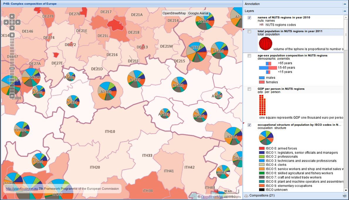
The Plan4business project was focused on spatial data used for, or resulting from, spatial planning activities, their integration and reuse. Spatial planning data include land use data as defined by the INSPIRE directive [3], statistical data, hydrography, flood data, protected sites, transport networks, cadastral parcels and other data used for spatial planning purposes.
The Plan4business project developed a service platform for aggregating, processing and analysing spatial planning data. This platform enables user to effectively reuse spatial planning data for different purposes in various specialisms.
[1] Koski, H., 2011. Does Marginal Cost Pricing of Public Sector Information Spur Firm Growth?
[2] International Organization for Standardization, 2005. ISO 19109 – Geographic information – Rules for application schema.
[3] “territory characterised according to its current and future planned functional dimension or socio-economic purpose (e.g. residential, industrial, commercial, agricultural, forestry, recreational).” (European Commission 2010a)